Measuring Urban Surface Reflectivity and Heat Mitigation Potential at High-Resolution with Remote Sensing and Machine Learning
At WRI, I worked on a project to identify the surface reflectivity of roofs and pavements in urban areas using machine learning and remote sensing. We built on the methods developed in Ban-Weiss et al. 2015a & 2015b and scaled them through cloud computing and machine learning. We used official footprint data from LA city, Microsoft building footprints and OpenStreetMap/SharedStreet API to get geometries of roofs and streets. Using open-source satellite imagery from National Agriculture Imagery Program (NAIP), ground truth measurements collected through project partners, and regression machine learning, we created high-resolution map of surface reflectivity for multiple urban areas in the United States. The resulting data and maps provide an estimate of the existing surface reflectivity at a building and street-segment scale which can be superimposed with current heat vulnerability, green infrastructure, urban morphology, and urban heat data. This tool serves cities in developing and evaluating urban heat island reduction strategies and promoting extensive adoption of urban heat mitigation programs.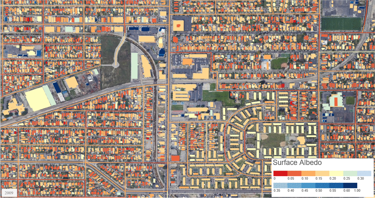
Prediction of mean albedo for every roof/street in LA city between 2009 and 2018. Credit: WRI/Microsoft AI for Earth/Global Cool Cities Alliance/City of Los Angeles/George Ban-Weiss/Sika AG/Federal Highway Administration Albedo Study/James E Alleman/Michael Heitzman.